-
 Manaslu - the mountain of soul
Manaslu Trek
Trip cost1580 USD Book this Trip
Trip Duration 17 Days
Destination Nepal
Trip Grade Strenuous
Activity Trekking
Transportation Private Vehicle
Accomodation Lodge to lodge
Meals Breakfast + Lunch + Dinner
Max. Altitude 5,106 m
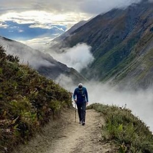
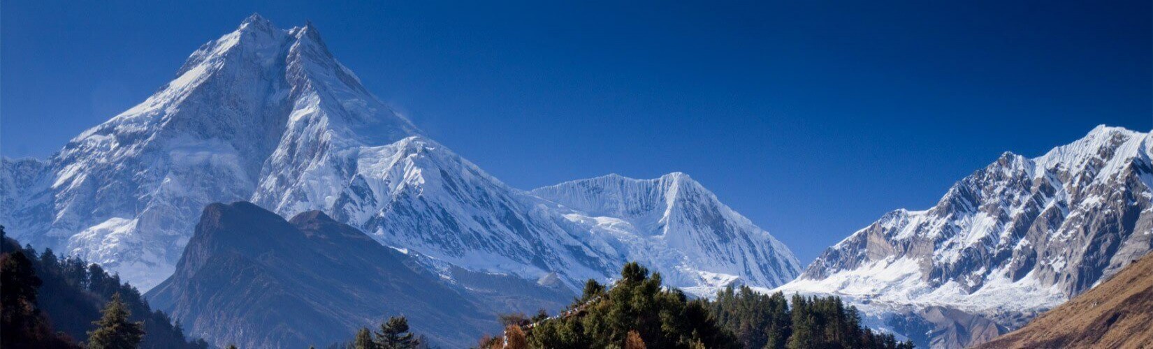
Manaslu trek encircles the Himalayan massif that includes Mt Manaslu the 8th highest peak in the world. The route is less trekked as it was only open in 1992 with restrictions of special permits and a liaison officer. It has been possible to do a teahouse trek only recently. The trek is popular for its blend of adventure, intact Himalayan Tibetan Buddhist culture and pristine nature. Hidden in the trans-Himalayan villages like Samdo, Sama and Namrung were isolated from the rest of the world until recently. While staying in the local family run teahouses offers opportunities of cultural immersion, the scenery is also one of the most picturesque in the Himalayas.
Trekking around Manaslu
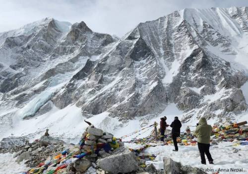
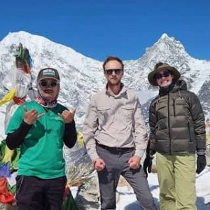
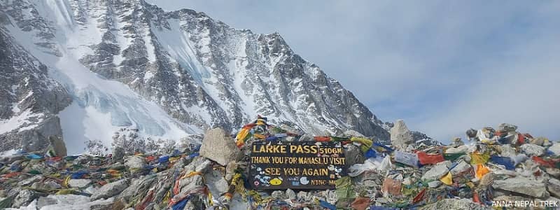
The trek starts from Kathmandu with a drive to Machhikhola. The trail follows Budi Gandaki River valley and traverses different ethnic and geographical territories to the northern side of Manaslu massif known as ‘Nupri’. The valley on the other side is majestic with an undisturbed view of Manaslu and other snow peaks. The locals are culturally and geographically close to Tibet. Locals could exploit the trade of Tibetan lake salt with grains from southern valleys and use the pastures of Tibet for grazing until 1960es. Larkya La pass at 5,106 m is the highest and the challenging part of the Manaslu trek. The pass is not technical but needs endurance for long, strenuous walk with precarious downhill on sleepy snow covered slopes. The pass was one of the main crossings for salt trading that connected Manaslu with Annapurna. On a clear day, the pass offers an overview of about a dozen of peaks including Mt Manaslu and Annapurna II.
Side trips and options
Our itinerary includes acclimatization side trip to Pungyen Gompa (4,700 m).
This side trip offers a spectacular view of Mt Manaslu and the Ganesh Himal range with glaciers and icefields. The other side trip in the itinerary is a hike to Ponker Lake. The hike to Ponker Lake is a day trip from Bhimtang on the other side of Larkya La pass.
You can also customize the Manaslu Trek with hidden side trips to the Himal Chuli Base Camp, Serang Gompa, Kal Tal, and Rui La Pass to see Tibet.
Trip Highlights
- Pristine trek in the Himalayas, opened only couple of decade back.
- New teahouse trekking as it was only possible with full fledged camping earlier.
- Side trips of Pungen Gompa (monastery) and Ponker lake.
- Option of a side hike to Rui La Pass (Tibet Border).
- Excurtion of one of the most intact Buddhist valley hidden in the Himalayas.
- Trek supporting local income in the region that was the epicenter of the 2015 Nepal earthquake.
Outline Day to Day Itinerary:
- Day 01:Arrive Kathmandu
- Day 02:A day in Kathmandu sightseeing
- Day 03:Drive to Machhi Khola (10 hrs / 869 m)
- Day 04:Trek to Jagat (7 hrs / 1,340 m)
- Day 05:Trek to Deng (7 hrs / 1,860 m)
- Day 06:Trek to Namrung (6 hrs / 2,630 m)
- Day 07:Trek to Shayla (6 hrs / 3,500 m)
- Day 08:Side trip to Pungyen Gompa (3,900 m / 4 hrs) & overnight in Sama Gaun (3,520 m / 1 ½ hrs)
- Day 09:Free day in Sama Gaun | Explore the valley and the village
- Day 10:Trek to Samdo (4 hrs / 3,875 m)
- Day 11:Trek to Dharmshala (4 hrs / 4,480 m)
- Day 12:Trek over Larkya La (Pass) 5,113 m to Bimthang (8 hrs / 3,890 m )
- Day 13:Excursion of Ponker Lake and another night in Bimtang
- Day 14:Trek from Bimthang to Dharapani (7 hrs / 1,963 m)
- Day 15:Drive back from Dharapani to Kathmandu or Pokhara
- Day 16:An extra day | Explore Bhaktapur
- Day 17:Drive to the airport for final departure
Detail Itinerary
- Day 01:Arrive Kathmandu Our represent will pick you up from the Kathmandu airport as per your flight details. Drive to the hotel and go on a familiarization walk in the evening if you are not tired.
- Day 02:A day in Kathmandu sightseeing Guided sightseeing of Kathmandu gives you an insight into local culture and etiquette. Kathmandu is melting pot of several culture and ethnic groups found across the county. Visit the World heritage sites with our learned local guide.
- Day 03:Drive to Machhi Khola (10 hrs / 869 m) We will drive west of Kathmandu on Prithivi highway for about 50 km and then take a road to Dhading Besi, the district headquarters town. From here, the road winds up to Gola Bhanjyang mountain pass and descends to the Ankhu river valley. Drive further across Salyantar to Arughat Bazaar. Arughat Bazaar is a bustling market town that serves as a trade and business hub for the region. We drive on the dirt road winding upstream the Kali Gandaki River to Machhi Khola.
- Day 04:Trek to Jagat (7 hrs / 1,340 m) The valley gets narrower with sparse population and dense mountainside. The trail follows river riverbank, swinging up and down at times to tackle unpassable gorges. We pass the village bazaar of Khorla Bensi and the Tatopani hot spring. Most of the walking will be through greenery in the higher reaches, switching to the right and life bank on a suspension bridge. The trail climbs along the old landslide debris, which blocked the river, making it gush down the boulders. Above the ridge, the valley opens wide with a stretching riverbed. Cross on the left bank at Lauri, and climb to Jagat village for an overnight stay.
- Day 05:Trek to Deng (7 hrs / 1,860 m) Follow the riverbank on a leveled path to the village of Ghatte Khola and cross to eastern bank of Budi Gandaki to climb up to Philim village. This is relatively bigger and prosperous village developed as a center for villages in the higher valleys. There is a regional office of Manaslu conservation area project. The trail follows the contour through the forest of pine and Rhododendron till the confluence of Kali Gandaki with Shyar Khola and then crosses on suspension bridge to the western bank then head towards northwest.
At this altitude we enter into Himalayan villages with pure Tibetan Buddhist influence, alpine lifestyle and farming culture. Population is sparser and the valley gets narrower with denser forest. - Day 06:Trek to Namrung (6 hrs / 2,630 m) The days walk is mostly along the forested bank of Budi Gandaki. We will climb high above the river basin to Rana village which offers the view of snow peaks. Descend to Ghap and then again cross to the southern bank to climb to Namrung village. The day is a felt harder as the air gets thinner and the day have relatively longer climbing so far.
At around Namrung, the valley starts to widen up again with view of snow peaks. The village is relatively prosperous and rich in Himalayan Buddhist culture. - Day 07:Trek to Shayla (6 hrs / 3,500 m) The walk gets more scenic with undisturbed Himalayan view and the colorful Himalayan Buddhist villages. We stride through Khani (Buddhist entrance gates), Mani walls and rustic monasteries bedecked with Buddhist paintings and symbolisms. The vegetation gets sparse with rocky faces of the buttresses of the snow peaks. Along the way, we will get the view of Mt Manaslu, Gorkha Himal, Dwijen Himal, Saula Himal, Lajing Peak and Peak 29. Overnight in Shayla village.
- Day 08:Side trip to Pungyen Gompa (3,900 m / 4 hrs) & overnight in Sama Gaun (3,520 m / 1 ½ hrs) Pungyen Gompa is the monastery named after the mountain god Pungyen Ri, ie, Mt Manaslu. The Nupri valley is the patron of the mountain god Pungyen Ri. The trip is one of the best ways to get a view of Mt Malanslu. There are no villages, but just pastures and the monastery in isolation.
The trail first climbs to the pasture and then winds through the pasture, climbing gradually to the monastery. Come back to Syala and trek 1 and a half hours to Sama gaun after lunch. - Day 09:Free day in Sama Gaun | Explore the valley and the village You can give total rest to your legs and let your lungs adjust to the thin air. Being active and an easy walk to higher reaches helps with better acclimatization. There is a day hike to see Birendra Lake and Manaslu Icefall.
- Day 10:Trek to Samdo (4 hrs / 3,875 m) The trail gradually climbs along the Kaligandaki river to Samdo, where the Budi Gandaki river valley braids. The trail is more arid with just a bunch of juniper and sea buckthorn on the side of the mountains. From Samdo, Tibet is just about 4 km. The village used to be the center of the salt trade. One can see Mt Manaslu, Samdo peak, Nagdi Chuli, and Simnang Himal on a clear day.
- Day 11:Trek to Dharmshala (4 hrs / 4,480 m) The scenic walk continue across the Budi Gandaki. We leave the Gandaki River we have been following and gradually climb towards Larkya pass. We pass the grazing marked as Larkya Bazaar which still signifies the importance of trans-Himalayan trade. Climbing gently, we come to scant ground at 4,460 m which used to have Dharamshala (rest house). There is a simple guest house now a days that facilitate teahouse trekkers.
- Day 12:Trek over Larkya La (Pass) 5,113 m to Bimthang (8 hrs / 3,890 m ) This is not really a place to rest but to wait for next day’s predawn when everyone comes to a momentum. The long stretch of walk through the glacial moraine to the altitude of over 5,000 m and the descent on the snow slope makes the day toughest. The view is however rewarding to make you forget the difficulty. At Larkya La, view of western view appears surreal daunting peaks of Himlung Himal, Kangurru and Annapuran II and the Manaslu. Descend is not easier on the snowed slope and loose scree. The slippery descends are leveled off by yak pastures finally ends at Bimtang (3,590 m).
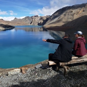
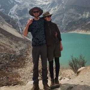
- Day 13:Excursion of Ponker Lake and another night in Bimtang Ponker Lake is one of the pristine Lake surrounded by majestic snow peaks. It takes about 4 - 5 hours for an excursion to the Ponker Lake at 4,100 m.
- Day 14:Trek from Bimthang to Dharapani (7 hrs / 1,963 m) Leaving a challenging and memorable trek behind, we again start to descend to the lush southern valley west of Mt Manaslu. The trail follows the Dudh Khola valley through the pine and Rhododendron forest, coming to clearings of meadows with Himalayan views. Tilije is the major Gurung village we come across in the valley. The village has apple orchards and brews brandy. 1 hr down the valley, we join the popular trail of Annapurna circuit at Dharapani.
- Day 15:Drive back from Dharapani to Kathmandu or Pokhara Our jeep will come to pick you up at Dharapani. Drive downstream the Marshyangdi valley along the popular Annapurna Circuit trek. The drive is scenic with a view of lush mountains, waterfalls, and charming villages. Tal village has got beautiful waterfall. The drive on a mountainous dirt road takes about 3 hours for 35 km to reach Besisahar. From Besisahar, a smooth ride on blacktopped road takes about 6 - 7 hours to reach Kathmandu or Pokhara.
- Day 16:An extra day | Explore Bhaktapur Having an extra day at the end can be used as a buffer day for the Manaslu Trek in case of bad weather or some unforeseen circumstances. There is also an option of visiting the medieval town of Bhaktapur for half a day.
- Day 17:Drive to the airport for final departure Our representative will come with a vehicle to pick you up for a drop-off at the airport as per your flight schedule. Exchange a warm farewell to all new friends you have made and leave with lots of good memories.
Cost Includes
- Necessary trekking permits. Restricted area permit, MCAP, ACAP (Annapurna Conservation Area Project) and TIMS (Trekking Information Management System)
- Private SUV /4WD to and back from the trekking trailhead
- Trekking with a licensed and experienced guide and necessary porters.
- Teahouse accommodation with three meals a day during the trek.
- Airport pick up and drop off as per agreement.
- 4 nights' accommodation in Kathmandu with breakfast and taxes included, based on Hotel Holy Himalaya.
- Guided sightseeing with all entrance fees included.
Cost Excludes
- Any type of insurances. Rescue and evacaution will be done on your account.
- Delay and cancellation because of natural phenomenon.
- Meals beside beakfast while in Kathmandu or Pokhara.
- Bottled drinks and beverages, toiletries and things of personal nature purchased by clients.
- Tea breaks and snacks bought by clients beside three meals.
- Tips for guide and porter.
-
Alice C
United Kingdom Published: Tuesday, April 15, 2025Did it again !
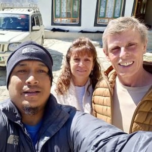
After an incredible trek with them to the Langtang valley in March, they arranged another awe inspiring trek for us to the Manaslu circuit. Rabi created an itinerary that suited our desires & Prabin expertly guided us through it. We added a side trip to the Tsum Valley, which was a wonderful and highly memorable experience. Prabin is a truly brilliant guide, he always put our safety and well-being first. His knowledge of the birds and the trees, of the land and the culture made the trek fascinating in many different ways. He also is so much fun, which made every day a joy! Thank you Rabi and Prabin, we hope this will not be our last trek with you. We heartily recommend Anna Nepal Trek !
Useful Info
Manaslu trek is becoming popular as an alternative after motorable roads reached most of the Annapurna trails. As the motorable road is connecting more villages of Budi Gandaki valley, the trekking trail of Manaslu is also becoming shorter. The politically and culturally sensitive trans-Himalayan regions of Manaslu are regulated by imposing special restricted area permits. Here is some more useful information about the Manaslu trek.
Trek difficulty and physical fitness
Manaslu trek is a difficult trek which involves crossing over 5,200 m Larkey La pass, hiking for about 6 hours on average in rugged terrain and changing weather conditions and basic logistic support. The trek is only for those with reasonable fitness level and previous experience of hiking. Even though special mountain trekking skills are not required, regular workout before coming on a trek helps a lot. Cardio exercises, gym, cycling, and hikes for at least two months before the journey make the trek much enjoyable.
Weather related challenges
Manaslu trek starts from subtropical hot and humid valley basin and goes to the trans-Himalayan dry and arid alpine terrain within a span of a week. So expect drastic change in weather and temperature within a short period of time. It is possible to walk in shorts or light full sleeve clothes during the day if you are trekking in peak season. Evening and night gets colder as we go higher. March till May and October and November are the best time of the year to trek in Manaslu. Expect to walk in the snowfield or even snowfall during the trek until mid April. The month of May sees pre monsoon clouds and rainfall. February, September and December are shoulder seasons for the trek which sees only fewer trekkers. However the monsoon rain subsides but will continue throughout September. Landslides and flooding from the monsoon may change the trails and the itinerary. IF you travel in September, keep your itinerary flexible. December and February days are mostly warm and sunny with clear skies. However, the temperature may drop to -15 C at higher elevation.